


 20 / 90

20
www.MountPleasantMagazine.com|
www.ILoveMountPleasant.com|
www.MountPleasantPhysicians.comTimeLine
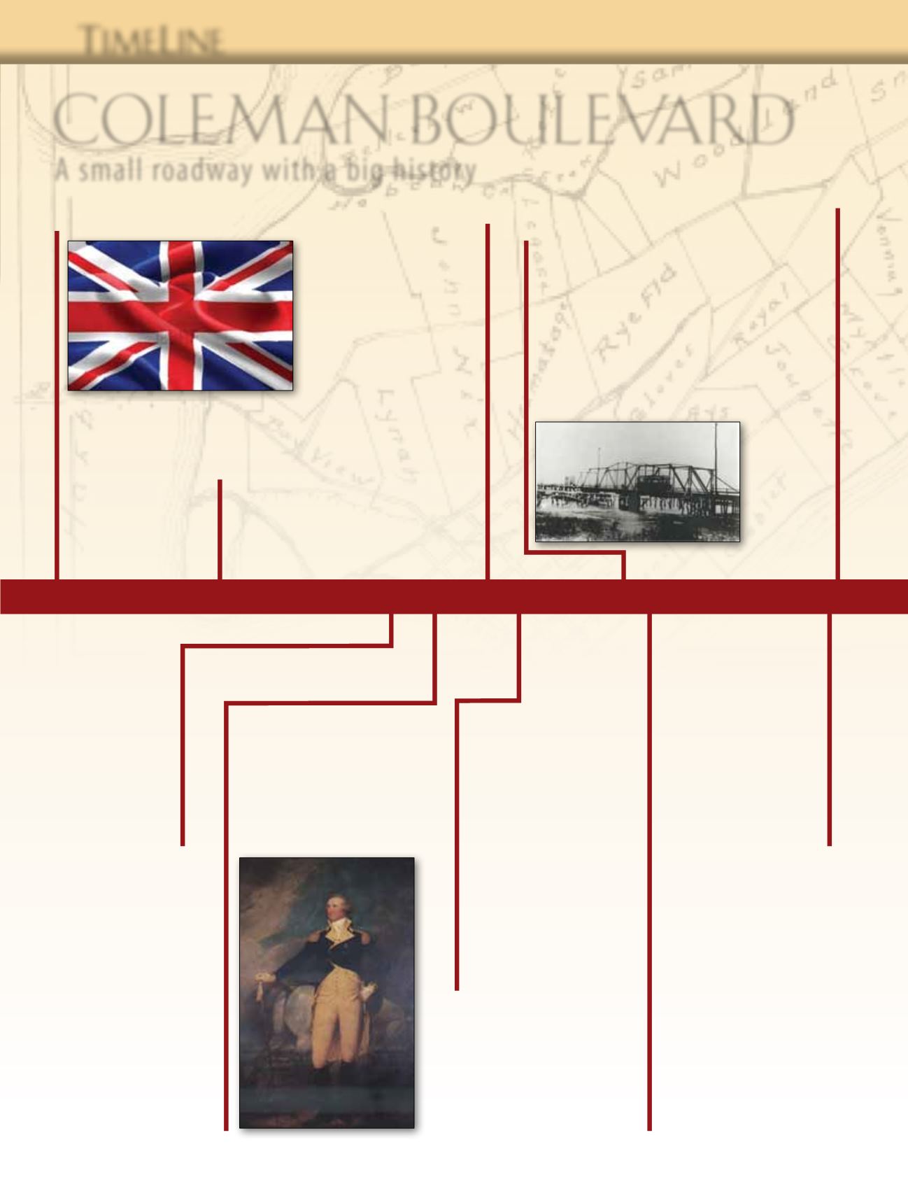
1650
– King
Charles II of England
directs the Colonial
governors to build a
road to connect the
Colonies.
1770
– Andrew Hibben
operates Hibben
Ferry, the first ferry
service connecting
Charles Town to the
King’s Highway.
1791
– President
GeorgeWashington
makes his Southern tour
along the King’s Highway.
John Trumbell’s painting
of Washington celebrates
this visit.
1898
– A ferry
service brings tourists
from Charleston to
Mount Pleasant, where
they board a trolley
that takes them to
Sullivan’s Island and
what is now called Isle
of Palms, a new resort.
1735
– The King’s Highway,
a 1,300-mile wagon route from
Boston to Charleston, South
Carolina, is completed.
1825
– A
survey by Robert
Mills denotes a road
between Georgetown
and Charleston as
Georgetown Road, an old
Indian“broad path.”
1819
– President
James Monroe visits
Charleston with his
secretary of war, South
Carolina native John
C. Calhoun. They are
entertained by a number
of prominent citizens in the
East Cooper area.
1900
– Ocean Highway
is created by designating
existing roadways along the
East Coast for motor vehicles.
The route runs from New
Brunswick, New Jersey, to
Jacksonville, Florida. In South
Carolina, where the route
turns inland to the village of
Mount Pleasant, it is known
as Route 40.
1927
– Ocean
Highway is incorporated
into Route 17, a North-
South federal road that
runs along the coast from
Porta Gunda, Florida, to
Winchester, Virginia.
1929
– The Cooper
River Bridge opens and
Route 17 joins with Route
40 in Mount Pleasant, by
way of a road across the
Charleston peninsula,
therefore shortening the
route north.
COLEMAN BOULEVARD
A smal l roadway wi th a big hi stor y