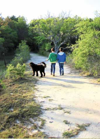
Less than 50 years ago, Rifle Range Road was a quiet rural route surrounded by small farms. Today the farms are gone and cars speed by, bringing folks to one of the many residential neighborhoods that line the roadway. Many are unaware of a hidden retreat that lies behind the Mount Pleasant Waterworks complex.
When I was asked to write about Marsh View Trail, my first response was “What’s that?” I met Catherine Main, executive director of the East Cooper Land Trust, at the entrance to the trail behind the Mount Pleasant Waterworks complex on Rifle Range Road, and we strolled the quarter-mile paved walkway that meanders through more than 50 acres of woods and marshland.
I left Mann armed with a folder of information, but there was still much to learn about this “secret garden.” I elicited the help of my friend, Julie Cliff, a former Wando High School biology teacher, who also knew nothing about the trail. A few days later, as I waited for Julie on an overcast Sunday, an older couple emerged from the entrance, and, as we chatted, they acknowledged that they were frequent trail walkers. As Julie and I prepared to begin our journey, the couple warned us that the path was flooded from the rain the day before.

Not far from the entrance is the dog park, fenced so large dogs can enjoy one area while small ones play in the other. We passed a young man with a chocolate lab who also warned us that the trail was wet. Undaunted, we made our way to the butterfly garden, where plants and flowering shrubs, specially selected to attract butterflies, were slowly emerging after a harsh winter. The garden was added in the spring of 2012, a project made possible by community volunteers. Just to the left of the garden is a beehive, a recent Girl Scout project, and the bees were active.
Armed with a handout we picked up at the information board, Julie and I headed along the trail, carefully dodging puddles. As we entered a densely wooded area, Julie explained that this is one of the few maritime forests remaining that are accessible to the public. A canopy of loblolly pine, live oak, laurel oak and magnolia almost blocked out the sky and Julie remarked, “I bet this is cool in the summer.”
We hadn’t gone too deeply into the forest when we discovered the trail was buried under water. After all, marshland has a propensity for returning to its natural state following heavy rains. As we returned to the butterfly garden, a young female jogged past us, and we shouted a warning that was ignored. While we sat on one of the benches in the garden, the jogger returned and said, “I should have listened to you.”
Julie and I returned a few days later to complete our tour. She was pleased to see that the forest land was left in its natural state, with an abundance of native shrubs. It reminded me of the woods behind my childhood home, where my brothers and I spent most of our youth exploring.
As the trail transitions into the salt marsh, there are smaller and fewer trees because of the salt spray. Julie pointed out the bright red shiny berries of the yaupon holly that are a particular favorite of local birds, among them the colorful male buntings that are visible from April until September. She showed me the edible pickle weed, and we tried to identify tracks that led across the trail into sandy marsh paths.
The smell of pluff mud greeted us just as the scene changed again and opened to a breathtaking panoramic view of the marsh. A protected bench invites visitors to relax and observe the ever-changing marsh – the seasons and tides offer an exceptional habitat for numerous birds, fish, mollusks and other water species. It was low tide, and Julie explained the mating ritual of the male fiddler crab. He waves his dominant claw in hopes of attracting an admiring female. She showed me trails etched in the mud made by the tiny periwinkle snails as they glean algae from the sand and plant life. As we sat and chatted on the bench, we gazed across the marsh at the raised land masses with trees and other green foliage, remnants of old sand dunes, known as hammock islands. To the left and barely discernible is the Isle of Palms Connector, and, far to the right and mostly hidden, is the causeway leading to Sullivan’s Island. We were soon joined by an older woman and her two beautiful black labs, who bounded up to greet us but soon lost interest and dove into a nearby creek.
At the beginning of the millennium, Mount Pleasant officials realized that due to the town’s rapid growth, natural lands were being lost to development. In 2002, the town created the East Cooper Open Space Foundation, with a mission to “identify and conserve natural spaces of environmental, cultural or historical value.” The foundation also sought to “provide natural lands such as parks, gardens and trails for people to enjoy.”
In 2009 the foundation obtained autonomy from the town and became the Mount Pleasant Land Conservancy. A year later, the MPLC acquired a conservation easement to establish the Marsh View Trail on 57 acres behind the Mount Pleasant Operations Center on Rifle Range Road. In 2013, the MPLC realized that its scope and vision extended beyond Mount Pleasant’s boundaries and became the East Cooper Land Trust, which encompasses the area between the Cooper and Santee Rivers.
Catherine Main partners with community volunteers to expand the organization’s mission and sphere by identifying vanishing natural lands and establishing protective easements so that these lands will be enjoyed by future generations.
To learn how you can help the East Cooper Land Trust, visit [email protected] or call (843) 224-1849.
Photos courtesy of the East Cooper Land Trust.
Story by Pam Gabriel

Leave a Reply